Floodplain Mapping

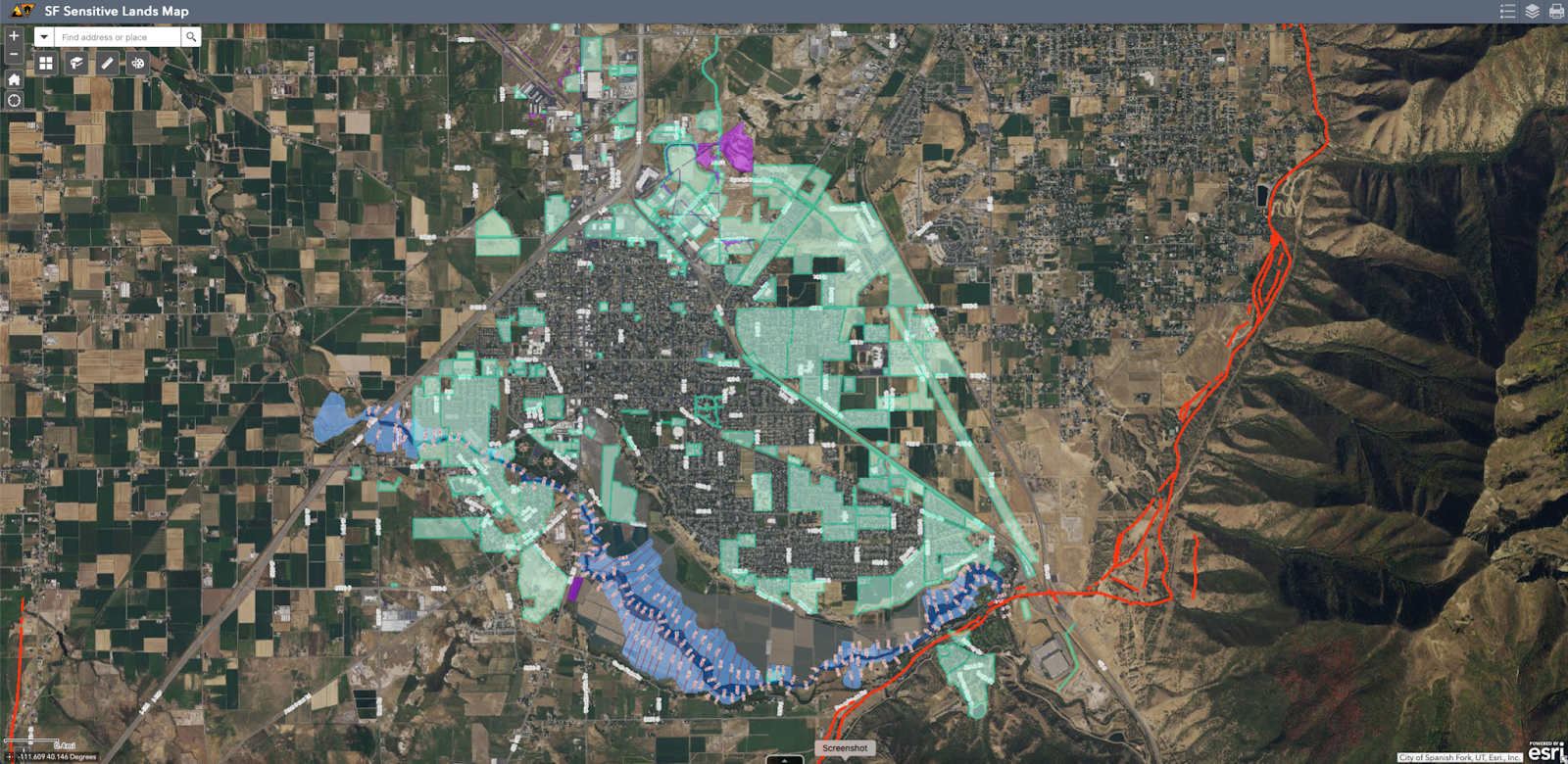
-Have you ever wondered if you are in a Flood Zone. Luckily we are here to help you find out. We have prepared a Sensitive Lands Map that among a lot of other helpful information such as Geotechnical Reports (studies on the soils to see what is there), Wetlands, Fault Lines, Liquefaction Zones (If there is an earthquake, because of the soils underneath you, how likely is it that your house will start to sink), has a Flood Plain layer shown with the blue colors near the river. In addition to the flood plain, we also show the Base Flood Elevations (Water Elevation in a 100 Year Flood). You can click on any flood plain area and get information about it. Here is a breakdown of the zones:
A - Zone A is the flood insurance risk zone that corresponds to the 1-percent-annual-chance floodplains that are determined in the FIS by approximate methods. Because detailed hydraulic analyses are not performed for such areas, no BFEs or base flood depths are shown within this zone.
AE - Zone AE is the flood insurance risk zone that corresponds to the 1-percent-annual-chance floodplains that are determined in the FIS by detailed methods. In most instances, whole-foot BFEs derived from the detailed hydraulic analyses are shown at selected intervals within this zone.
AH - Zone AH is the flood insurance risk zone that corresponds to the areas of 1-percent-annual-chance shallow flooding (usually areas of ponding) where average depths are between 1 and 3 feet. Whole-foot BFEs derived from the detailed hydraulic analyses are shown at selected intervals within this zone.
Zone AO - Zone AO is the flood insurance risk zone that corresponds to the areas of 1-percent-annual-chance shallow flooding (usually sheet flow on sloping terrain) where average depths are between 1 and 3 feet. Average whole-foot base flood depths derived from the detailed hydraulic analyses are shown within this zone.
Zone X - Zone X is the flood insurance risk zone that corresponds to areas outside the 0.2-percent-annual-chance floodplain, areas within the 0.2-percent-annual-chance floodplain, areas of 1-percent-annual-chance flooding where average depths are less than 1 foot, areas of 1-percent-annual-chance flooding where the contributing drainage area is less than 1 square mile, and areas protected from the 1-percent-annual-chance flood by levees. No BFEs or base flood depths are shown within this zone.
Floodway - Nothing can be built in the floodway.
Mill Road Roundabout
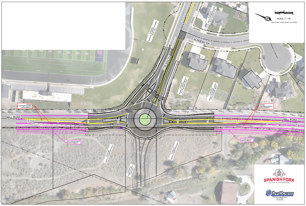
Engineering is just completing the design of the proposed roundabout at 1100 South MIll Road. Construction should begin June 1 and be complete by the time school begins this fall.

